By Verónica Gormaz Muñoz, Faculty of Engineering / vgormaz@udec.cl | Photos: Courtesy of Faculty of Engineering
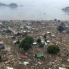
Nature reminds us from time to time that we live in a territory that regularly shakes. Sometimes, earthquakes in far-flung places, such as in Turkey and Ecuador in 2023, awaken ghosts of the destruction previous earthquakes have inflicted on our country, and we think about how we will prepare for those to come.
Although it is not yet possible to accurately specify when an earthquake will occur, progress has been made in obtaining valuable information from each earthquake and using it to reduce future adverse effects. This has been done in Concepción since 2018 at ORSCA, the Alluvial Basin Site Response Observatory, a pioneering center in South America, led by Gonzalo Montalva, who is a professor from UdeC’s Faculty of Engineering and a researcher at the Milenio Cyclo Hub.
This natural observatory has eight seismometers, six on the surface, located in places with different geological and geotechnical conditions: the Hogar Freire-UdeC; the Geotechnics laboratory in UdeC’s Department of Civil Engineering; in UdeC’s Department of Earth Sciences; the Sagrados Corazones School; the Fourth Company of Firefighters of Concepción; and the Faculty of Law of the Catholic University of the Most Holy Conception. An observation well was also built at Hogar Freire-UdeC on bedrock at a depth of 80 meters. It has been equipped with two seismic stations in addition to the surface one: an intermediate one at 40 meters and another on the bedrock. This distribution covers different site conditions: ground, rock, and depths to the bedrock.
ORSCA is an initiative funded by the ANID FONDEQUIP program through the EQM 160015 project. All the data collected can be accessed for free and downloaded from http://www2.udec.cl /~geotechnics/.
What does it mean to have ORSCA’s seismographs?
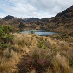
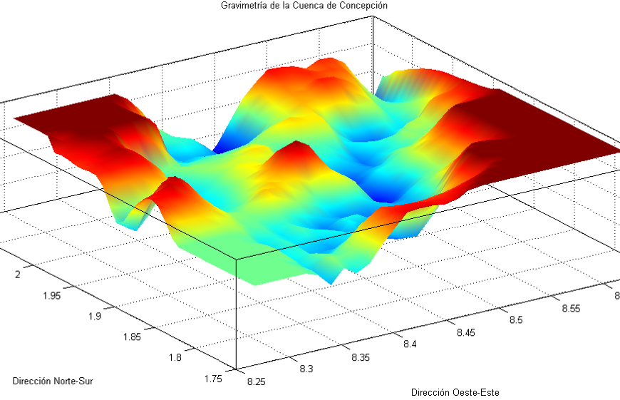
– The behavior of the city and its structures against earthquakes can be estimated better, distinguishing spatial differences in seismic intensities and damage levels from the so-called site effects. In this context, the impact of surface or site geology, understood as the characteristics of rocks and soils in the first 500 meters, is a matter of global interest, especially when the bedrock’s shape is highly variable, as it is in the city of Concepción, which is why ORSCA chose the Concepción basin as a natural laboratory.
What data have the seismographs obtained?
– For example, the surface measurements of the Mw 6.2 Concepción earthquake in December 2022 show that at a greater depth, the intensity that would primarily affect tall buildings is up to six times greater than in a rocky outcrop and twice as much as for sites with a depth to the bedrock of approximately 60 meters. This condition was also seen in the 2010 Maule megathrust earthquake (Mw8.8), so tall structures’ most significant seismic amplification could be recurrent at the city’s heart, the deepest in the basin. Hence, the expected structural response will depend on the location and structural typology of the civil works.
And how could this information be used for the benefit of the community?
The results would improve the specific seismic response predictions of the site under analysis, considering each place’s geotechnical and geophysical properties. In short, the aim is to reduce the uncertainty associated with the seismic hazard of Concepción and extrapolate it to other basins in Chile and the world. For the 2010 earthquake, we had no instrumentation other than old equipment that began measuring when the quake started. The previous phase, which is very important, was not recorded and, thus, lost. Now, we have both the instrumentation and the information.
How does this information influence current regulations?
Today, almost all sites located in the Concepción basin are classified similarly and, therefore, designed as such because national and international regulations still do not recognize basin effects such as those observed in Concepción.
Today, there is a project to update the seismic design of buildings regulations (NCh433), which was requested by the Ministry of Housing and Urbanism under the coordination of the Construction Institute and led by Professor Gonzalo Montalva. This project aims to standardize seismic threat studies for specific sites. These studies make it possible to improve what the design standard prescribes for a structure seismically or even to determine design values for special situations that fall outside the scope of existing standards.
Last modified: 3 de septiembre de 2025